Demo Abstract: SmartParcels A What-If Analysis and Planning Tool for IoT-Enabled Smart Communities

Abstract
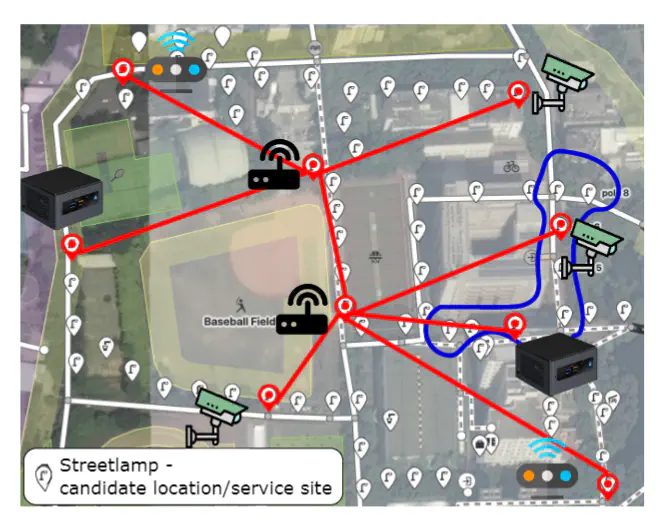
We present a tool, SmartParcels, that assists urban planners in deploying applications in smart communities. The deployment involves the mapping from information units (generated from data analytics), infrastructures (sensing, networking, and computing devices), to geophysical locations. SmartParcels provides two design schemes, clean-slate (planning from scratch) and retrofit (exploiting existing devices). Moreover, SmartParcels allows users to control the trade-off between optimality (sensing coverage and accuracy) and efficiency (execution time) for the design results. Finally, users can perform a dynamic traffic simulation with different background network traffic to study the result plan’s ability to handle the community’s dynamic traffic. SmartParcels then allows users to finetune the results according to the user’s domain knowledge.